Mapping cherry fruitlets
to assist thinning
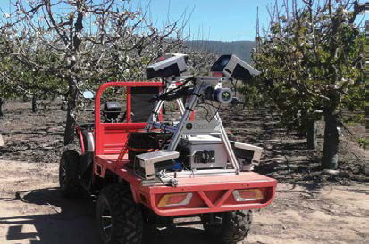
CARTOGRAPHER is attached to an ATV and driven up and down the orchard rows before and after thinning to provide a map of fruit density for every tree.
BY AUSTRALIAN TREE CROP
There’s a new piece of farm equipment operating on CherryHill orchards in located in Victoria’s Yarra Valley, Murray Valley, Goulburn Valley and Victorian High Country.
Brimming with cameras, laser sensors and flashing lights, it doesn’t look like the other machinery, but in its third year of operation, it has earned its place alongside the conventional machines used each year for quality cherry production.
In 2019 the directors of CherryHill, Glenn and Stephen Riseborough were looking for a way to improve their cherry thinning process. They recognised that successful thinning is a key driver for quality fruit and profitability but were concerned by how difficult it can be to achieve consistent thinning every year.
They were already investing considerable effort in assessing the fruit load by eye, so they wanted to know if this could be done better and more efficiently by a camera mapping system.
Meanwhile, after nearly a decade of research and experimentation in robotics and sensing for orchard mapping, Sydney-based company Green Atlas had just been established to commercialise exactly this type of system, with their first product called Cartographer.
They had a successful start in 2018, mapping apple flowers, fruitlets and fruit, when the Riseboroughs approached to ask about cherries.
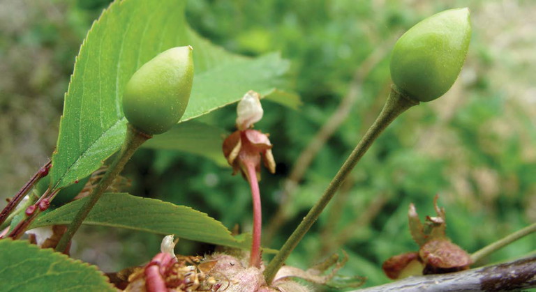
“To be honest, we weren’t completely sure back then if we could detect cherry fruitlets at less than 10mm in size,” says James Underwood, co-founder of Green Atlas.
“We were honest about that, but they said they really needed this technology and were keen to give it a go.”
“We had to change to higher resolution cameras, but then it worked really well.” Cartographer has been in commercial use in cherries ever since, with customers in Australia, North and South America.
At CherryHill Orchards, Cartographer is used every year throughout the fruit thinning season.
It’s attached to their own ATV and operated by farm staff — driven up and down the orchard rows before and after thinning, to provide a map of fruit density for every tree. “It’s very easy to use,” said Navarra Robanakadavu, farm manager for CherryHill, based at Cobram.
“It’s really amazing. I can see where the heaviest areas are that need thinning, and after thinning I can confirm the job has been done well,” he said.
“It’s great technology, really impressive,” said Stephen Riseborough.

The Riseborough’s innovative attitude and willingness to try something new has paid off. “It’s great technology, really impressive!” said Stephen Riseborough. CherryHill is about to commence their fourth season with Green Atlas Cartographer.
Mr Underwood said that since their start in 2018, Green Atlas Cartographer is now in commercial use in five continents, working with the majority of different tree fruit and nut crops industries.
The business has expanded from mapping apple and cherry fruitlets for thinning, and now supports diverse farm operations from flower thinning in apples, to mistletoe (weed) removal in macadamias, and orchard sanitation (mummy nut removal) in almonds, as well as mapping canopy geometry and yield prediction for most crops. ●
MORE INFORMATION
For more information on the Cartographer, visit https://greenatlas.com/cartographer/